Urban Planning
- Create fast and accurate topographic surveys of the existing terrain that can be used by architects to design urban projects and new constructions
- Integrate final designs and templates of future projects directly into the 3D model to better visualize the future impact of the project in its environment
- 3D animations and are videos made to promote future urban and real estate projects to potential investors or the general public and local populations
What Uzufly does for you
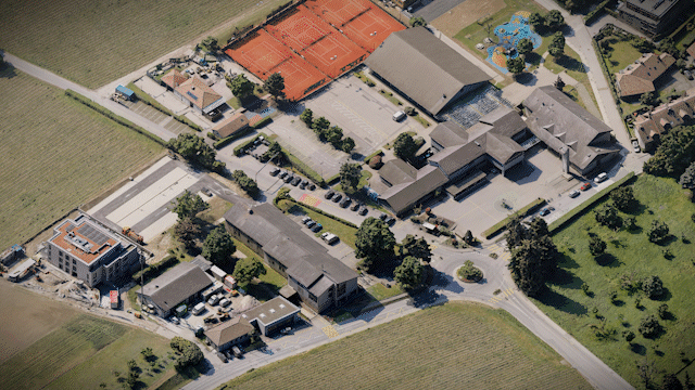
Today, during the development phase of urban projects and new constructions, architects and engineers rely on poor quality and old field data (e.g., Google Earth survey several years old). In addition, designs for future projects are shared among stakeholders using complex 2D plans or computer-generated images that provide little information about the final impact of urban projects.
Our 3D models, created from aerial images, represent an ultra-realistic and recent copy of the existing terrain and allow to improve and support the development phase of new urban projects.
Our 3D models, created from aerial images, represent an ultra-realistic and recent copy of the existing terrain and allow to improve and support the development phase of new urban projects.